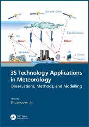
3S Technology Applications in Meteorology: Observations, Methods, and Modelling
- Добавил: literator
- Дата: 28-08-2023, 20:02
- Комментариев: 0
 Название: 3S Technology Applications in Meteorology: Observations, Methods, and Modelling
Автор: Shuanggen Jin
Издательство: CRC Press
Год: 2024
Страниц: 441
Язык: английский
Формат: pdf (true)
Размер: 55.7 MB
Spatial information technology and its integration, such as remote sensing, geographic information systems (GIS), and global navigation satellite systems (GNSS), known as 3S technology, have been extensively utilized in managing and monitoring natural disasters. This book illustrates the 3S integrated applications in the field of meteorology and promotes the role of 3S in developing precise and intelligent meteorology. It presents the principles of 3S technology and the methods for monitoring different meteorological disasters and hazards as well as their application progress. The case studies from the United States, Japan, China, and Europe were conducted to help all countries understand the 3S technology functions in handling and monitoring severe meteorological hazards.
3S technology specifcally refers to the Global Navigation Satellite System (GNSS), Remote Sensing (RS), and Geographic Information System (GIS). 3S technology, as the core technology of spatial informatics, can provide a full range of resource and environmental data and quickly obtain multi-platform, multi-temporal, multi-band, high-precision and high-resolution massive space-time information. The combination of 3S technology observations in meteorology can overcome the shortcomings of traditional meteorological instruments such as low accuracy and poor self-adaptive capability for observing certain meteorological parameters. For example, images acquired from satellite remote sensing can draw a map of water distribution in the atmosphere and rainfall distribution through light recognition equipment and infrared sensors, which can effectively improve the observation ability of rainfall in heavy rainstorms. GNSS Radio Occultation (GNSS RO) can achieve high vertical resolution and spatial coverage of the atmospheric parameter profles, which can effectively solve the problems of poor stability and low vertical resolution of traditional observation means such as radar and reanalysis data and effectively improve the monitoring ability of meteorological disasters. 3S technology can not only enrich the means of meteorological observations and improve the ability of meteorological observations, but also collect, store and analyze meteorological data by GIS. For example, GIS can carry out statistical analysis of meteorological disaster data, assess meteorological disasters risks and improve the ability to defend against meteorological disasters. GIS can also evaluate the disaster situation of meteorological disasters through the integration and analysis of information. Therefore, 3S technology has become an important means of meteorological observation, processing and analysis, and can improve the comprehensive management and assessment of meteorological disasters. With the development of 3S, more closely combined meteorological parameter observation and disaster monitoring and forecast will be constantly improved.
The “3S” is the general name of Global Navigation Satellite System (GNSS), Geographic Information System (GIS), and Remote Sensing (RS), which is the integration of space technology, satellite navigation and positioning technology, computer technology, sensor technology and other disciplines. The 3S technology system is used to quickly acquire spatial data using RS and GNSS and use GIS as the basic platform to store, manage and analyze spatial information. The GNSS is a satellite-based radio timing and navigation system that provides high precision time and spatial location data for users in aviation, space, land and sea, online or offine.
Features:
- Presents integral observations from GNSS, GIS, and remote sensing in estimating and understanding meteorological changes
- Explains how to monitor and retrieve atmospheric parameter changes using GNSS and remote sensing
- Shows three-dimensional modelling and evaluations of meteorological variation processing based on GIS
- Helps meteorologists develop and use space-air-ground integrated observations for meteorological applications
- Illustrates the practices in monitoring meteorological hazards using space information techniques and case studies
This book is intended for academics, researchers, and postgraduate students who specialize in geomatics, atmospheric science, and meteorology, as well as scientists who work in remote sensing and meteorology, and professionals who deal with meteorological hazards.
Скачать 3S Technology Applications in Meteorology: Observations, Methods, and Modelling
Внимание
Уважаемый посетитель, Вы зашли на сайт как незарегистрированный пользователь.
Мы рекомендуем Вам зарегистрироваться либо войти на сайт под своим именем.
Уважаемый посетитель, Вы зашли на сайт как незарегистрированный пользователь.
Мы рекомендуем Вам зарегистрироваться либо войти на сайт под своим именем.
Информация
Посетители, находящиеся в группе Гости, не могут оставлять комментарии к данной публикации.
Посетители, находящиеся в группе Гости, не могут оставлять комментарии к данной публикации.
