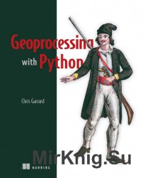
Geoprocessing with Python
- Добавил: bhaer
- Дата: 7-10-2016, 09:30
- Комментариев: 0

Название: Geoprocessing with Python
Автор: Chris Garrard
Издательство: Manning Publications
Год: 2016
Страниц: 360
Формат: PDF
Размер: 27 Mb
Язык: English
This book is about the science of reading, analyzing, and presenting geospatial data programmatically, using Python. Thanks to dozens of open source Python libraries and tools, you can take on professional geoprocessing tasks without investing in expensive proprietary packages like ArcGIS and MapInfo. The book shows you how.
Geoprocessing with Python teaches you how to access available datasets to make maps or perform your own analyses using free tools like the GDAL, NumPy, and matplotlib Python modules. Through lots of hands-on examples, you’ll master core practices like handling multiple vector file formats, editing geometries, applying spatial and attribute filters, working with projections, and performing basic analyses on vector data. The book also covers how to manipulate, resample, and analyze raster data, such as aerial photographs and digital elevation models.
What's inside
Geoprocessing from the ground up
Read, write, process, and analyze raster data
Visualize data with matplotlib
Write custom geoprocessing tools
Three additional appendixes available online
Внимание
Уважаемый посетитель, Вы зашли на сайт как незарегистрированный пользователь.
Мы рекомендуем Вам зарегистрироваться либо войти на сайт под своим именем.
Уважаемый посетитель, Вы зашли на сайт как незарегистрированный пользователь.
Мы рекомендуем Вам зарегистрироваться либо войти на сайт под своим именем.
Информация
Посетители, находящиеся в группе Гости, не могут оставлять комментарии к данной публикации.
Посетители, находящиеся в группе Гости, не могут оставлять комментарии к данной публикации.
